Bolong Fm
Type Locality and Naming
Tieklik region (SW Tarim Basin). The Bolong Fm was named by Ma Shipeng et al., in 1979 and was formally published in 1989. The typical section is located in Bolong in the west of the Xinjiang-Tibet Road, in the south of Yecheng County, Xinjiang Weiwuerzhu Zizhiqu (Xinjiang Uygur Autonomous Region). Lower formation of the Qiakmakelik Gr.
Synonym: (波龙组)
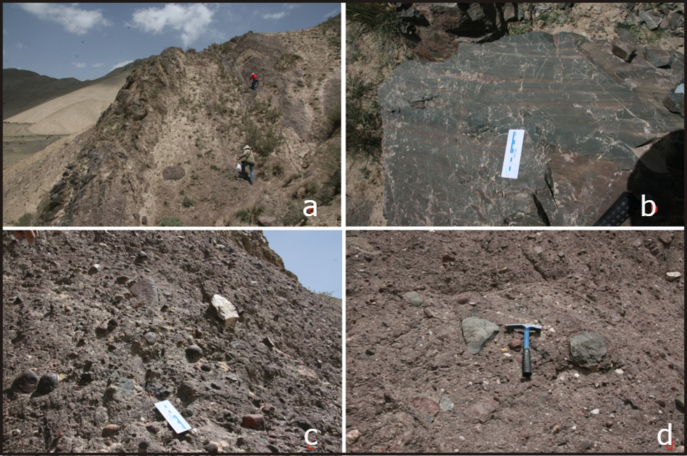
[Figure: The type-section of the Bolong Formation in West Kunlun. a-The section of the Bolong Formation; b-Siliceous rocks, the bottom of the Bolong Formation; c,d-Diamictites]
Lithology and Thickness
The Bolong Fm is the formation of marine glacial rock (diamictite), which is dominantly composed of gray massive moraine-type diamictite intercalated with siliceous mudstone, siltstone, shale, turbiditic sandstone and detrital flow breccia. The thickness varies from 500 to 1216 m.
Relationships and Distribution
Lower contact
The Bolong Formation disconformably overlies the Yalaguz Fm
Upper contact
It is conformably overlain by the varvite of the overlying Kelixi Fm
Regional extent
Tieklik region (SW Tarim Basin). It is dominantly distributed in the southwest of Yecheng County in the north slope of West Kunlun, Heluostan River, Qipan River, Qiakmakelik Valley in the west of the Xinjiang-Tibet Road and south of Pishan County.
GeoJSON
Fossils
It yields abundant microplants (including 30 genera and 39 species), dominated by Leiopsophosphaera sp., Protoleiosphaeridium sp. Leiominuscula sp., Zonosphaeridium sp., Nucellosphaeridium sp., Macroptycha sp., in addition, Trachysphaeridium sp., Taeniatum sp. etc.
Age
Depositional setting
Marine glacial rocks (diamictite)
Additional Information
